2010 GPS Surveying Draft Protocol.pdf
Here’s the GPS Surveying Protocol. Post some comments with thoughts, ideas, and changes.
|
||||
|
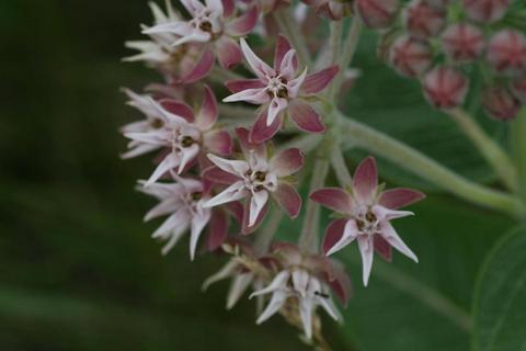
2010 GPS Surveying Draft Protocol.pdf Here’s the GPS Surveying Protocol. Post some comments with thoughts, ideas, and changes. XML is packaged for R via CRAN and is based on RSXML. Perhaps this will make it easier to parse the XML that the Topcon software puts out, or easier than trying to parse it all yourself. 2010 Stipa Draft Protocol.pdf. The Google Docs wasn’t really working out… Comment with your thoughts and changes. Having stickered and scanned all of the collected Stipa seed (great job Ian, Hillary, and Lauren!) we’ve gone through and stuck them all into their foamy rows. 1700ish seeds later, we’re ready to plant out in the common garden! Here’s a few pictures:
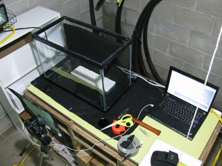
Check it out on youtube. It’s even available in full HD! I’m actually just linking this because this blog isn’t wide enough to fit the whole movie. So I think I have my basic setup for the time-lapse photography for checking out those stipa awns. Using one of Greg’s aquariums, a camera, tripod, computer and such. I’ll be able to change the humidity soon enough and really start the experiment. Some of the stipa, just as a test And here’s my setup. Off to the left of the aquarium is the 500W halogen light. The seeds and black felt are inside the aquarium. In front of that is the camera with a blind on the front to help knock down some glare from the front glass. Attached is the computer, which is what I’m using to control the time-lapse.
I dumped the topcon’s gps data into a csv. this data hasn’t been cleaned and contains a couple errors that have yet to be fixed, but it should be enough to flesh out some R magic to help parse the output. The point number, lat, long, and {all the entered data for the points} are comma seperated, the least being one big glob of stuff. The first couple values are proper points but the wrong dictionary, so those will have to be done seperately.
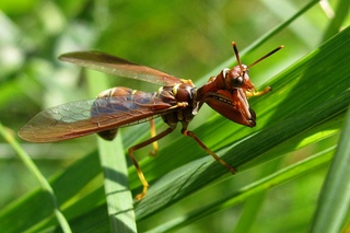
Ok, you have to enlarge this photo. Climaciella brunnea: the Wasp Mantidfly is really neither of those things (well, it’s a mantidfly, but you know what I mean). It’s not a wasp (order Hymenoptera, includes bees and ants, too) nor is it a mantis (order Mantodea, pretty much just mantids). It’s actually more related to lacewings and antlions (order Neuroptera). Doesn’t it just look strange? So these are the Stipa that have been collected so far. I’ve labeled a couple of the places on the map. I was having trouble projecting the data exported from GPS Pathfinder Office (trimble) and noticed that no coordinate system was defined (same issue with the DOQ maps Stuart gave me; the GeoTIFFs didn’t have a spatial definition). The GPS data should be North American 1983 in the Geographic Coordinate System folder (right click on the data in ArcCatalog, hit the XY Coordinate System tab and hit the Select button). The DOQ maps ought to be using the NAD_1983_UTM_Zone_15N from the Projected Coordinate System folder. Dumping all of these files into ArcMap (and a little fiddling) gave me this nice map. Next plan of attack is to make it work in GPS Pathfinder Office, as it’s much less complicated than ArcGIS. |
|
|||
|
© 2024 The Echinacea Project - All Rights Reserved - Log in Powered by WordPress & Atahualpa |
||||