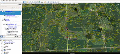
This summer I am going to be using Google Earth Pro and Rstudio to plot the GPS points of Echinacea plants. From there I will use an application called Soilweb to determine the type of soil where these points/plants are. I will then look into the different characteristics for that soil such as water holding capacity, nutrients, texture, or cation exchange capacity.
![Share on Twitter twitter](https://echinaceaproject.org/wp-content/plugins/social-media-feather/synved-social/image/social/regular/48x48/twitter.png)
![Pin it with Pinterest pinterest](https://echinaceaproject.org/wp-content/plugins/social-media-feather/synved-social/image/social/regular/48x48/pinterest.png)
![Share by email mail](https://echinaceaproject.org/wp-content/plugins/social-media-feather/synved-social/image/social/regular/48x48/mail.png)
Leave a Reply