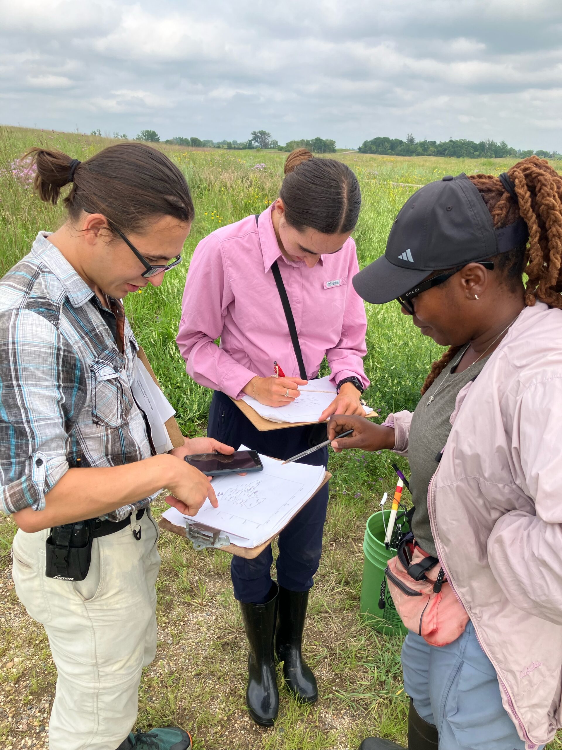
Team Echinacea has begun the annual census of Echinacea plants. Each year we census all flowering plants at over 30 prairie sites. Each plant gets a digital census record, a flag, and a tag. Most plants already have a tag, so we don’t give them a new one. But some have lost their tag or are flowering for the first time, so they need a new tag. New tags this year are numbered starting at 30,001. Plants get neon flags and we will come back and survey them so we can make a map of the location of every plant. Once they get surveyed, we replace the neon flag. All of these efforts help build a long-term dataset about the survival and reproduction of these very long-lived plants. These plants face many challenges living in small prairie patches, but they are tough.
Below is a summary of the number of census records taken so far at nine sites
   site              rawSite demo.id
1 other                            1
2   alf      around landfill      11
3    cg        common garden      23
4  eelr   east elk lake road      19
5   lfe        landfill east     118
6   lfw        landfill west      99
7   lce loeffler corner east      78
8   lcw loeffler corner west      81
9  rrxx    railroad crossing      36
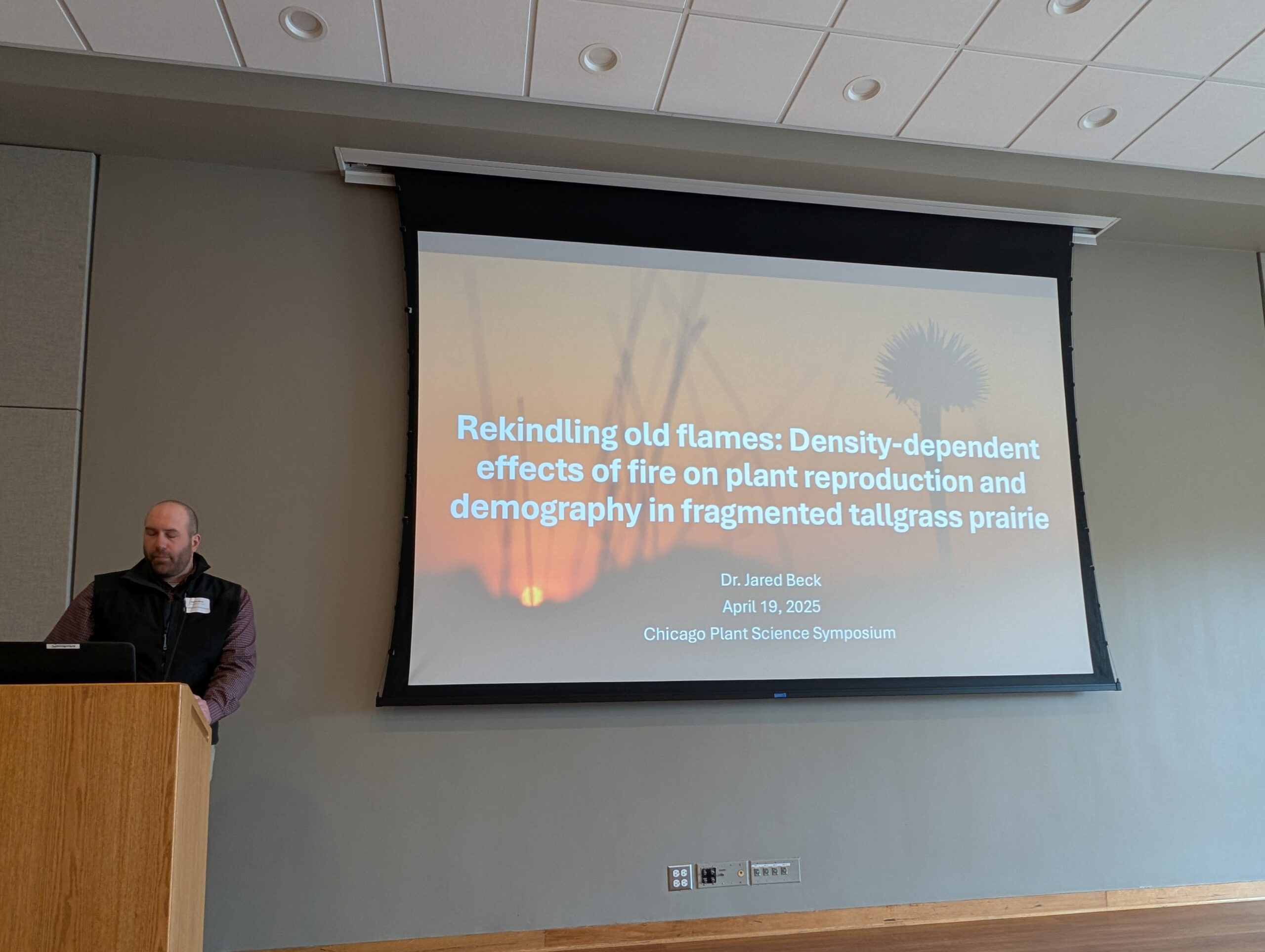
Jared gave a presentation at the Chicago Plant Science Symposium on April 19th about our big prescribed fire experiment. He focused this talk on fire effects on plant reproduction & demography.
This is part of our project “How Do Prescribed Fires Affect Native Prairie Bees?”
Funding for this project was provided by the Minnesota Environment and Natural Resources Trust Fund as recommended by the Legislative-Citizen Commission on Minnesota Resources (LCCMR).
Echinacea pallida is a species of Echinacea that is not native to Minnesota. It was mistakenly introduced to our study area during a restoration of Hegg Lake WMA around 2006 (Stuart’s recollection). This is concerning, because we don’t know how a similar species may impact or local Echinacea angustifolia! Will they hybridize? Could pallida outcompete angustifolia? Ever since pallida have started springing up, Team Echinacea has visited the pallida restoration, taken flowering phenology, and collected demography on the non-native plant. We have decapitated all flowering E. pallida each year to avoid cross-pollination with the local Echinacea angustifolia. Each year, we record the number of heads on each plant and the number of rosettes, collect precise GPS points for each individual, and cut off all the heads before they produce fruits.
This year, we cut E. pallida heads on June 26th. Overall, we found and shot 172 flowering E. pallida plants with 512 normal heads in total, averaging 2.98 heads per plant, though the max was 20 on a single plant! These non-native plants were hearty with an average rosette count of 7.20 rosettes and an astounding individual with a maximum of 88 rosettes. We did not take phenology data on E. pallida this year.
Team 2024 returns to their vehicles after flagging, taking demography data on, and decapitating Echinacea pallida at Hegg Lake WMA
Demography data: head counts, rosette counts, etc.
data in aiisummer2024 repo: ~/aiisummer2024/demo/demoGood2024.txt
Spatial location for every flowering E. pallida
data in aiisummer2024 repo: ~/aiisummer2024/surv/survGood2024.txt
Samples collected:
Echinaceapallida were not collected: decapitated heads were left on the ground next to the plants
A flowering echinacea at the aptly named nearby remnant “near pal” looked suspiciously like a hybrid (more robust than an angustifolia). We put a pollinator exclusion bag on the single head to prevent pollen spread, and later harvested the head and brought it back to the lab, where it is currently in the seed dryer. Keep an eye on tag 29239 in the future
Products:
None… yet! Besides a prairie with significantly less E. pallida reproduction
You can find more information about E. pallida flowering phenology and previous flog posts on the background page for the experiment.
Experimental plot 6 was the first E. angustifolia x E. pallida hybrid plot planted by Team Echinacea. A total of 66 Echinacea hybrids were originally planted. All individuals have E. angustifolia dams and E. pallida sires. In 2024, we visited 23 positions, 4 of which were can’t find year 3 in 2023 and didn’t get their final double check. We found living plants at all positions but those four (so, 19)! Last year, for the first time, 3 plants flowered in this plot. This year, no plants flowered.
Start year: 2011 (crossing) and 2012 (planting)
Location: Wagenius property
Overlaps with:
Common garden experiment
Data collected:
Measure data (status, size, etc.)
data in SQL database
Samples collected:
None (no flowering plants)
Products:
None… yet!
You can find more information about experimental plot 6 and previous flog posts about it on the background page for the experiment.
Experimental plot 7 is the second E. pallida x E. angustifolia plot. It contains conspecific crosses of each species as well as reciprocal hybrids, totaling 294 pdeigreed individuals. We took phenology records between July 10th and July 18th. There were 42 flowering plants this year; from these we harvested 87 heads. Heads in this plot were covered by pollinator exclusion bags during the growing season to prevent cross-pollination with nearby Echinacea populations.
Stuart demonstrates proper measuring technique in exPt07
Start year: 2012 (crossing) and 2013 (planting)
Location: Hegg Lake WMA (MN DNR)
Overlaps with:
Common garden experiment
Data collected:
Phenology data (dates of flowering stages)
data in cgData repo: ~/cgData/summer2024/exPt79Phenology
Measure data (status, size, etc.)
data in SQL database
Harvest data (IDs of harvested heads, missing achenes, etc)
detailed data in dropbox: dropbox/CGData/140_reconcile/reconcile2024/reconcileOut/2024harvestListReconciledExport.csv
data in echinaceaLab package (hh.2024)
Samples collected:
87 heads harvested
at CBG for processing
Products:
None… yet!
You can find more information about experimental plot 7 and previous flog posts about it on the background page for the experiment.
There were originally 745 seedlings planted in exPt09. Experimental plot 9 is a hybrid plot, but, unlike the other two hybrid plots, we do not have a perfect pedigree of the plants. That is because the E. angustifolia and E. pallida maternal plants used to generate seedlings for exPt09 were open-pollinated. At this point, some but not all plants in this plot were tested for paternity, revealing that there are some hybrids. This year, we took phenology records between July 9th and July 18th. During measuring, we searched at 292 positions and found evidence of 234 living plants in 2024. Of these individuals, 70 were flowering. We harvested 110 heads from this plot! Heads in this plot were covered by pollinator exclusion bags during the growing season to prevent cross-pollination with nearby Echinacea populations.
The team runs out reel tapes to aid in measuring exPt09
Start year: 2014
Location: Hegg Lake WMA (MN DNR)
Overlaps with:
Common garden experiment
Data collected:
Phenology data (dates of flowering stages)
data in cgData repo: ~/cgData/summer2024/exPt79Phenology
Measure data (status, size, etc.)
data in SQL database
Harvest data (IDs of harvested heads, missing achenes, etc)
detailed data in dropbox: dropbox/CGData/140_reconcile/reconcile2024/reconcileOut/2024harvestListReconciledExport.csv
data in echinaceaLab package (hh.2024)
Samples collected:
110 heads harvested
at CBG for processing
Products:
None… yet!
You can find out more information about experimental plot 9 and flog posts mentioning the experiment on the background page for the experiment.
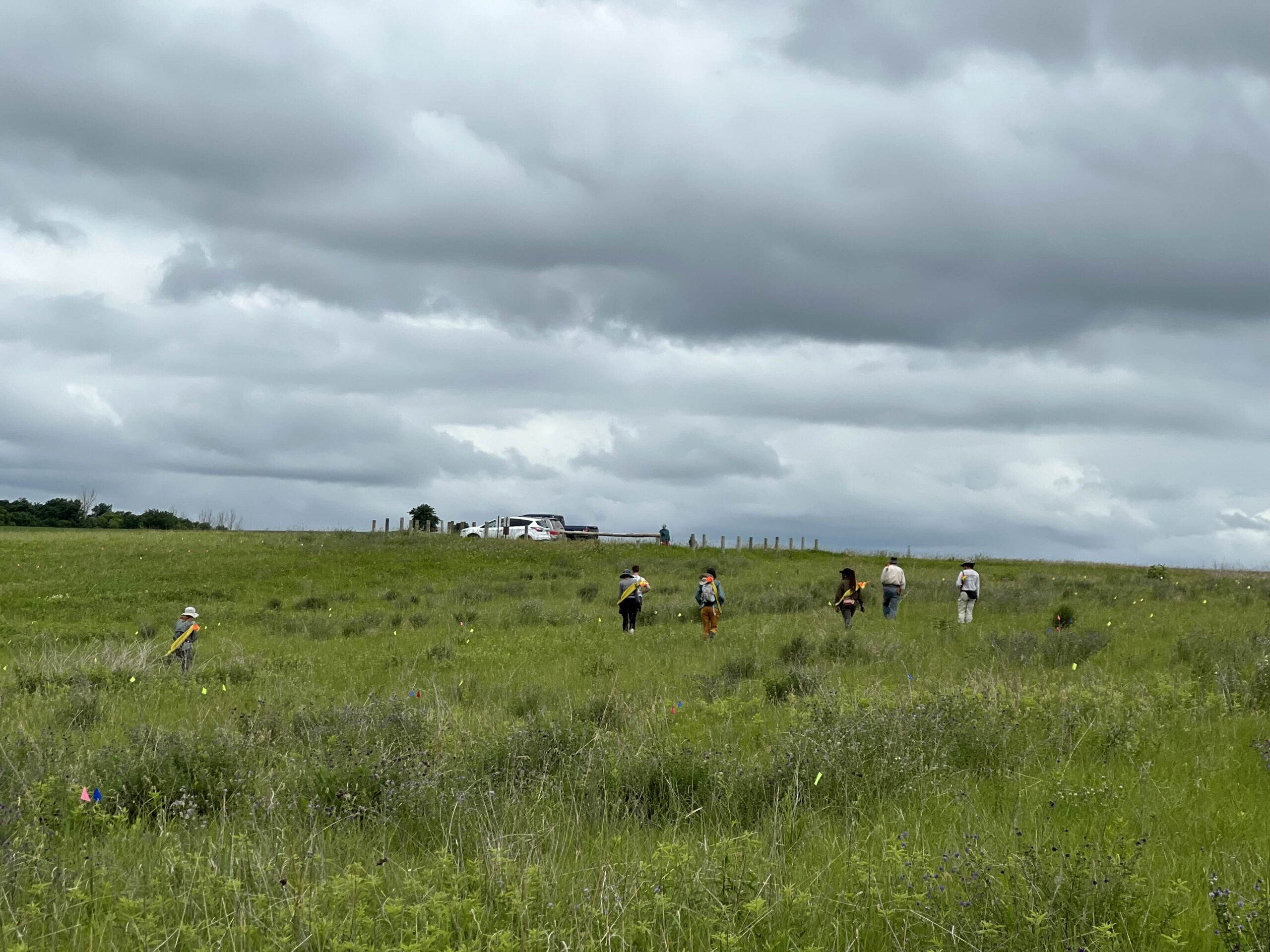
Team Echinacea finished Total Demo today! That was a big undertaking. We visited 2640 locations to search for Echinacea plants in our remnant sites. But we’re not done with our remnants yet. Today we started de-mopup or demopup. In the likely event that we missed a few flowering Echinacea, we revisit each site to do a thorough search. I am not sure if we are as thorough as this AI puppy mopping the floor, but we strive to find the Echinacea Plants that no one else will find.
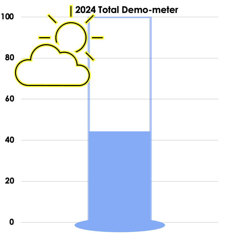
Let’s consult our total demometer to see how much progress we’ve made. The team has tackled some large sites in the past few weeks. We’ve made lots of progress! We’re about 45% done with all locs.
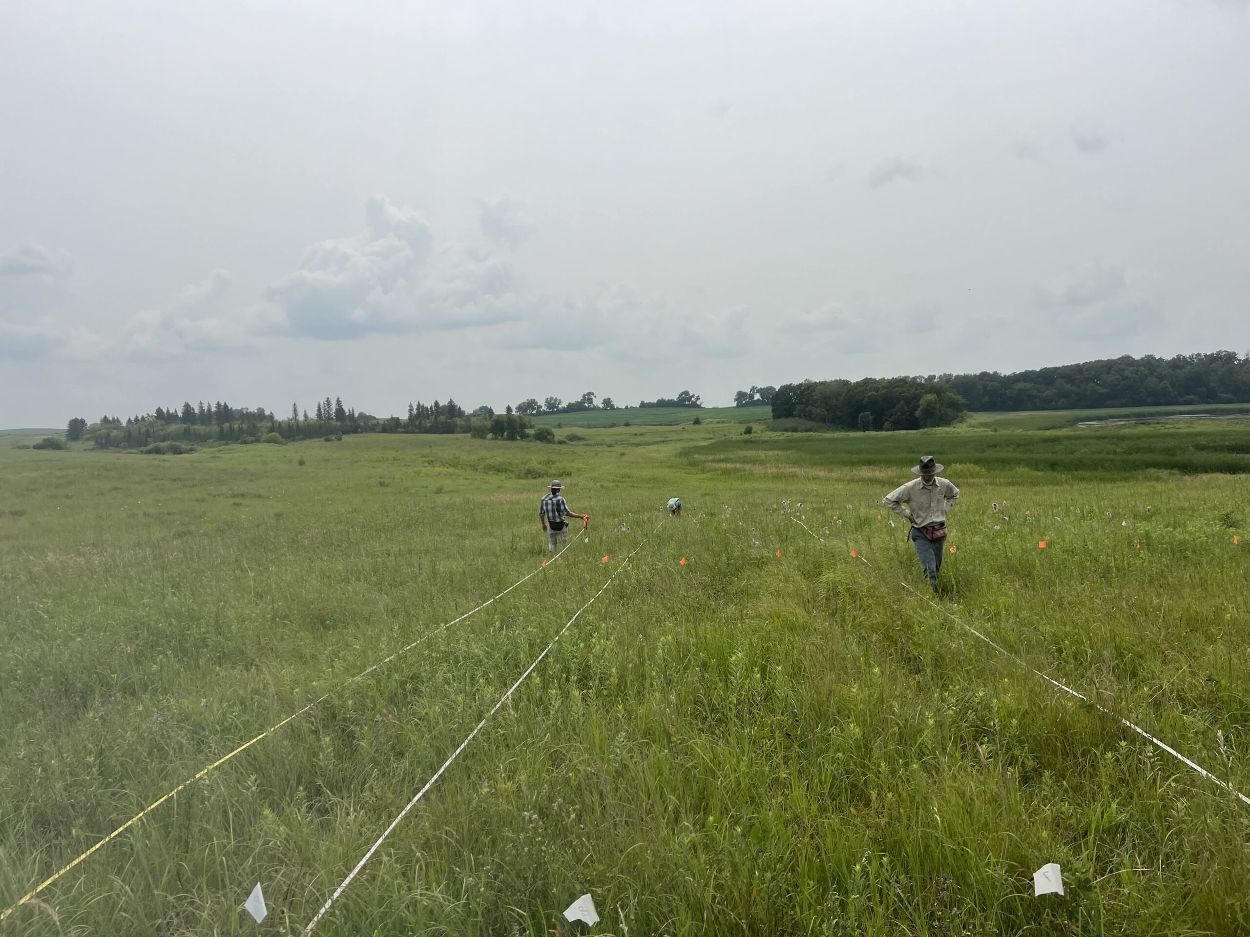
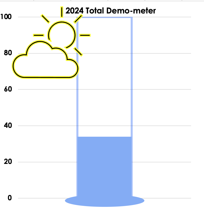
We are busy with fieldwork here in western MN! Between measuring, floral assessments, emergence trapping, searching for flowering plants, and finishing up our pollen and nectar collections, we have our work cut out for us… We’ve been making steady progress with total demo. As of this morning, we have completed 34% of the locs where we search for echinacea.
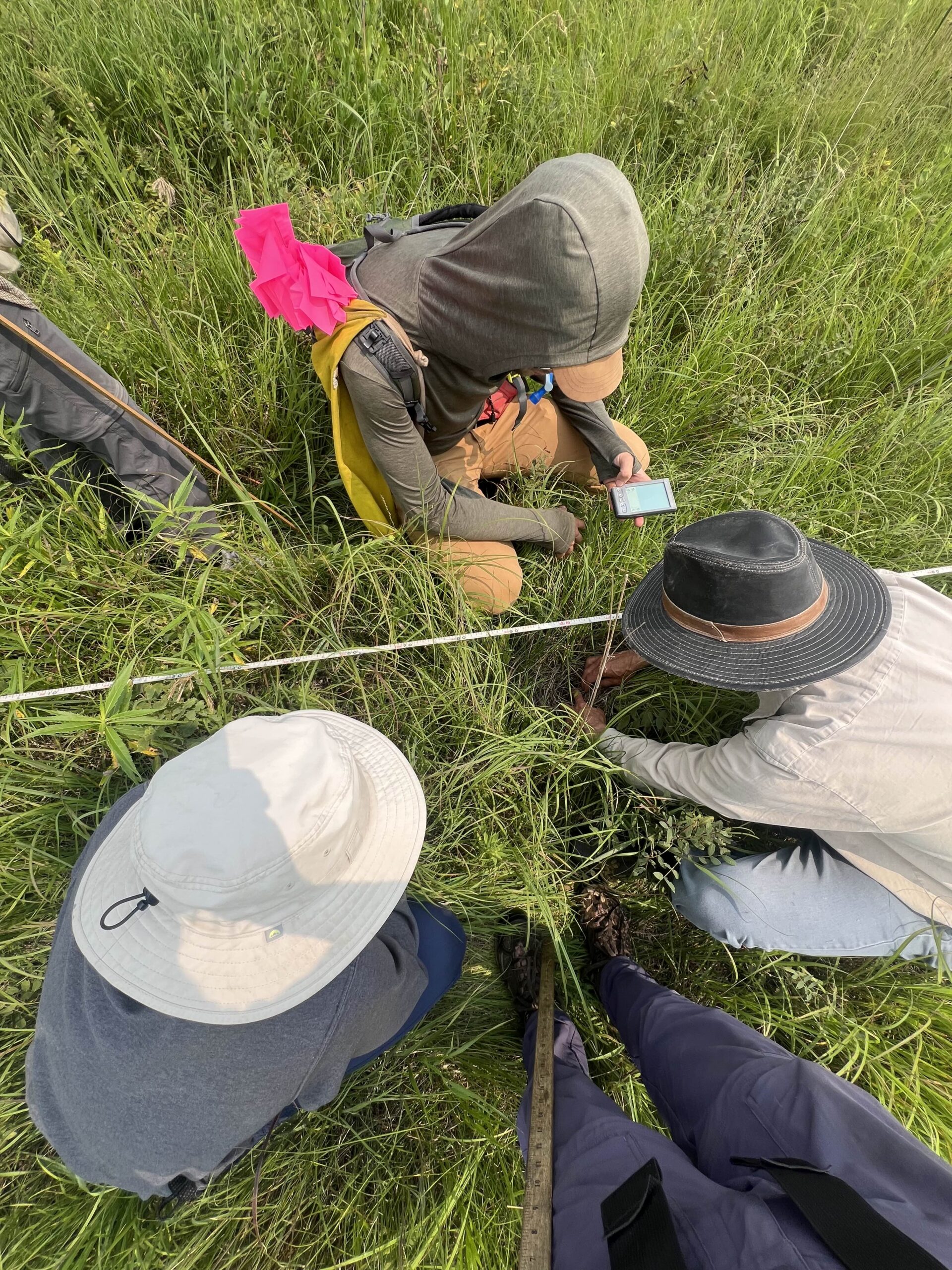
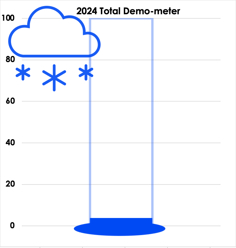
Total demo has commenced! Team Echinacea began to assess demography of flowering and non flowering Echinacea today!
We started at tower, a site with a rich demographic history. We payed special attention to tag 9301- a plant first tagged in 1996. Many members of Team Echinacea have met this plant before. Including me last year. This year, 9301 is basal and has 4 rosettes. I hope it has many more fruitful summers in store.
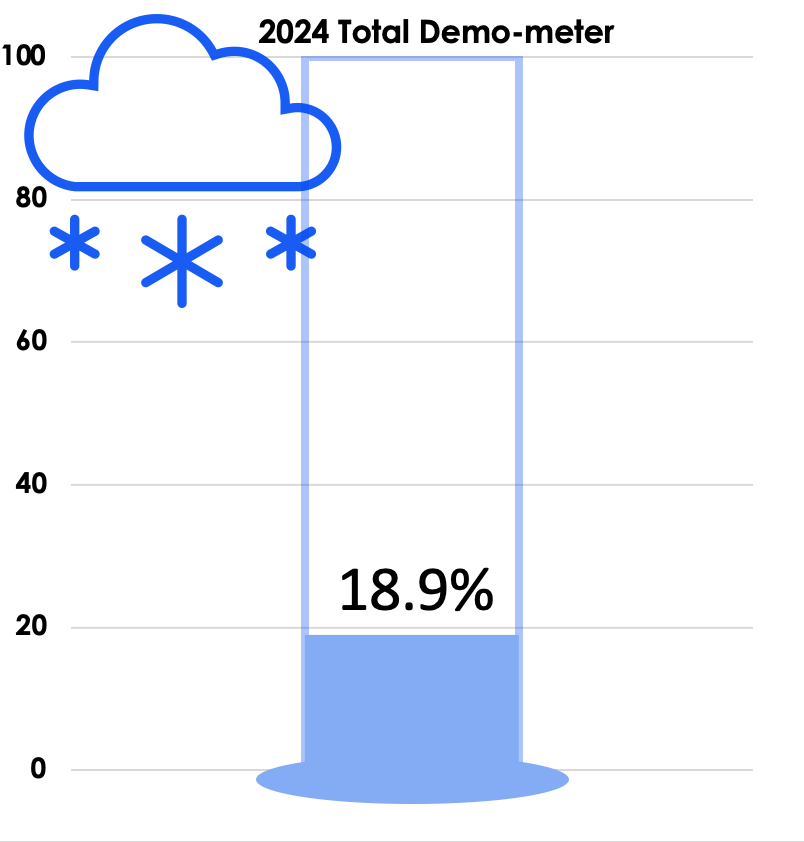
We’ve got 2,640 locations where we will search for Echinacea in 2024. Our work is cut out for us, but after just one morning in the field, we are already 3.75 % done!
Today Team Echinacea continued to wrap up the pollen and nectar collection. Only a few focal plants are still in flower. Another group worked on flagging and recording demographic information for every flowering Echinacea plant in every remnant site. Some of these plants have tags dating back decades! In the experimental plots, Stuart trained team members to find and measure all Echinacea. This data will help us understand performance of E. angustifolia x pallida hybrids. Round 5 of emergence trapping started recently. The team members are now pros at deploying and retrieving the traps.
It feels like forever ago that our summer team of plant demographers were taking demo and surv records on thousands of flowering and non-flowering Echinacea plants in the field! But for me, demo and surv work is still front and center, and it gets more exciting every day!
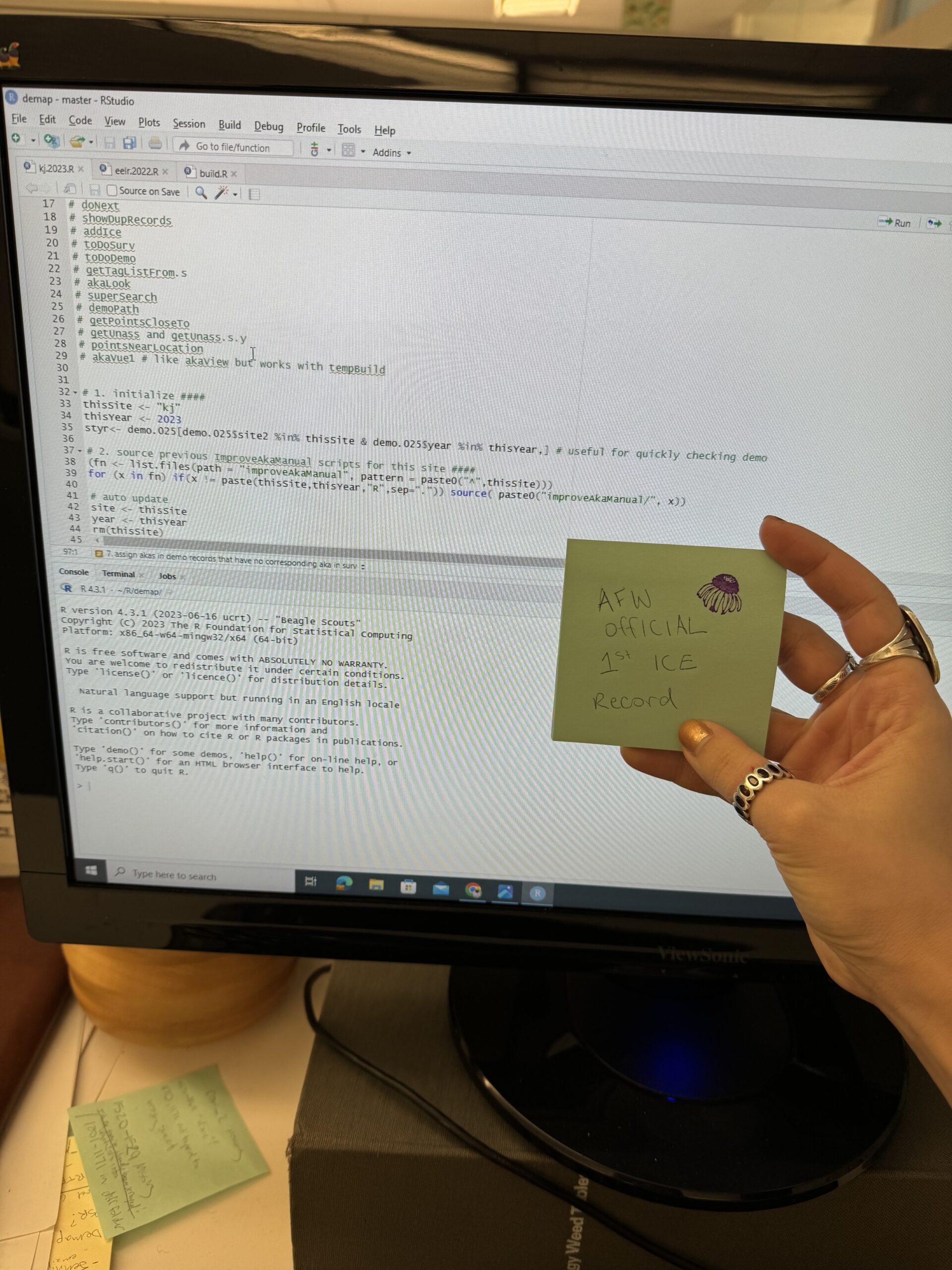
A few weeks ago, I cleaned up the 2023 data that Stuart and Jared kindly loaded into demap. Now, it is time to reconcile entries within years and between years. There is a lot going on in the demap repository where this happens, but luckily, former members of Team Echinacea wrote great protocols and annotated their scripts thoroughly.
On Friday I wrote my first ever “ICE” record (informed census evaluation) for an entry at Kjs. There will be many more to come as I solve little mysteries from data collection. Hopefully soon we will have successfully incorporated 2023 demographic data into our long-term database. Stay tuned!
A very official certification of my first ICE record.

