Good grief! As if regular old atmospheric inclement weather wasn’t enough to worry about, now we can worry about inclement ionospheric weather too! The fire season appears to be coming early and strong, which may make it difficult to conduct prescribed burns and work outdoors. The upcoming solar maximum appears to be coming early and strong, which makes it difficult to use our precision GPS machines, which are essential to our fieldwork.
Here’s a MnDOT bulletin from today warning us to expect bad performance of gps due to space weather rocking the satellites.
Network Ionosphere Unreliability Issues – a bulletin from MnCORS Minnesota Department of Transportation on 03/06/2024
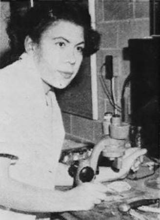
During the summer, we use two high-precision Topcon GPS units to map thousands of flowering Echinacea plants. Our GPS units are named Collins and Taylor, after two inspiring female scientists.
Dr. Margaret S. Collins
first Black woman to hold a PhD in entomology
researched defense mechanisms in termites
nicknamed the “Termite Lady”
civil rights activist
Dr. Marie Clark Taylor
first Black woman to hold a PhD in botany
researched photomorphogenesis, how light affects plant development and flowering phenology
developed high school science curriculum now used across the US
her curriculum promoted the use of real plants and microscopes in the classroom
Dr. Collins and Dr. Taylor were friends in real life, just like our GPS units that are often in the field together!
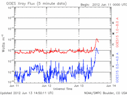
We delayed our fieldwork for a few minutes this morning because of scattered showers. Who knew we should have delayed for a few more minutes because of Solar X-Ray Flux?
The National Weather Service’s weather radar indicated that the rain (aka atmospheric H2O flux) was mostly south of us, so we knew it would be a short delay. However, we should have checked NOAA’s space weather forecast…
When we arrived at the site, the atmospheric weather was OK, but the space weather was poor and our gps machine, Sulu (a Topcon GRS1), had a difficult time getting oriented. It may have been groggy because of the burst of solar X-Ray Flux. Here is the graph of Solar x-ray Flux from NOAA:
Just our luck! Next time we’ll check our local weather forecast and the space weather forecast!
I dumped the topcon’s gps data into a csv. this data hasn’t been cleaned and contains a couple errors that have yet to be fixed, but it should be enough to flesh out some R magic to help parse the output. The point number, lat, long, and {all the entered data for the points} are comma seperated, the least being one big glob of stuff.
The first couple values are proper points but the wrong dictionary, so those will have to be done seperately.
So, for those of you who were wondering what Team Echinacea will be doing tomorrow, here is the field protocol for the transect searches that we will be using.
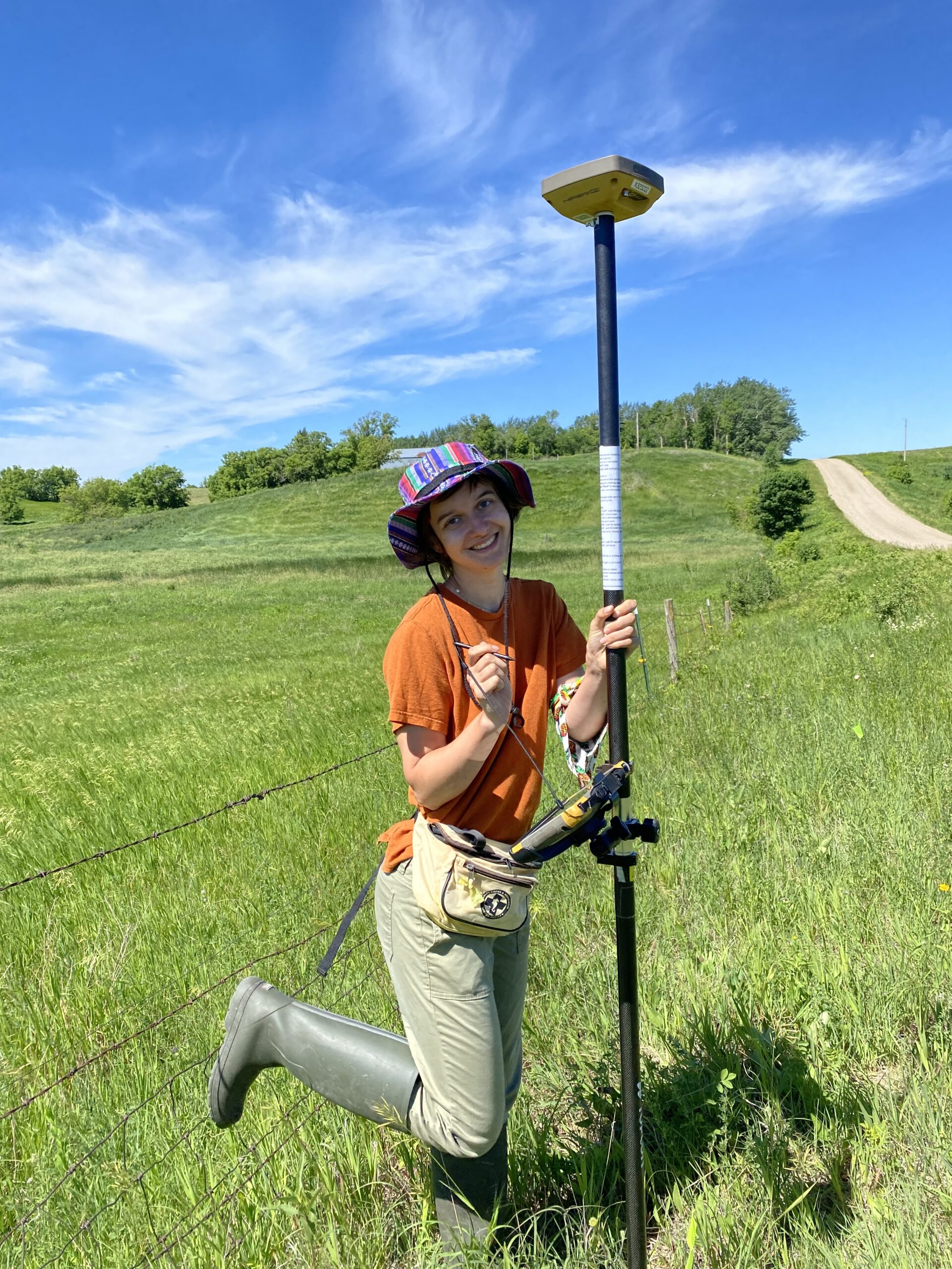
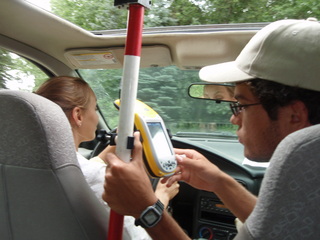
Also, we were searching for Stipa today (a prairie grass that Dr. Ridley is planning to add to the common garden), and this is the setup we used to mark the sites with the GPS:
The antenna allowed us to get about a 9 cm margin of error when using the Trimble. And yes, that is yours truly manning the antenna, ensuring that the carrier lock is not lost. We were all ready to tell the next person who asked us what it was that we were searching for nuclear waste.
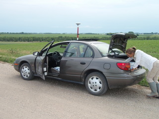
I collected GPS coordinates of plants at the landfill on Saturday with our Trimble GeoXH. It froze as I was getting ready to go to the Riley site. I didn’t know what to do. I didn’t have a reference manual, just the Quick Start Guide. For future reference, here’s the link to manuals and perhaps other helpful resources…