|
|
View image
So these are the Stipa that have been collected so far. I’ve labeled a couple of the places on the map.
I was having trouble projecting the data exported from GPS Pathfinder Office (trimble) and noticed that no coordinate system was defined (same issue with the DOQ maps Stuart gave me; the GeoTIFFs didn’t have a spatial definition). The GPS data should be North American 1983 in the Geographic Coordinate System folder (right click on the data in ArcCatalog, hit the XY Coordinate System tab and hit the Select button). The DOQ maps ought to be using the NAD_1983_UTM_Zone_15N from the Projected Coordinate System folder. Dumping all of these files into ArcMap (and a little fiddling) gave me this nice map.
Next plan of attack is to make it work in GPS Pathfinder Office, as it’s much less complicated than ArcGIS.
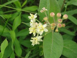
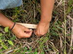
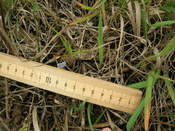
Here’s a picture of a Stipa seedling in the Common Garden. I’m about to create a form for entering data on our seedlings. We are debating if we should count and measure each leaf or count leaves and measure the length of just the longest leaf. Most of our time will be spent finding the plants and/or the toothpicks that we put in to mark them. So, taking the measurements of each leaf shouldn’t add that much time. Any thoughts?
Stuart and I did an initial investigation of about 30 locations where Stipa was planted. We found plants at 40-50% of the locations! Caroline, what was your estimate for germination of these seeds?

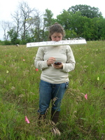
Josh, Gretel, Hillary, and Ian are also trained on the TopScan to collect the GPS data. The ideal is that the radio signal is at 100% and the designation of the location is described as Fixed – (Float will do and Auto works if you are unable to connect to a radio signal)
Josh and I plan to collect from Hegg Lake and the road adjacent on Monday. In the quest to collect from 300 parent plants, we are likely onto roadsides – where we are trying to stay at least a meter off the road and using plants about 5m apart from each other. Generally, as the black color appears and as the capsule opens around the pointy head, the seeds are ripe and will pop off as you gently pull up the stem containing the seeds.
I plan to be around Sun afternoon and Mon. to finish the collection before starting to cross some plants.
Stipa collection is going pretty well, aside from the Topcon being flaky and not connecting to the data network for improved accuracy (it should be good enough for refinding tags along with the metal detector). We’ve collected from 85 out of the desired 300 so far, with different averages of seeds collected depending on the site. Landfill and Staffenson both had rather high averages, somewhere around 9 or 10 (no math here, just guessing based on what I was entering in the data fields) while some of the scattered remnants were closer to 5 or 6.
As for today, I’ll be out with someone to go search at other sites, hopefully, but the weather is looking a bit questionable today. We’ll see!
This afternoon I spent some time with Terrasync, getting a data dictionary together for Hesperostipa seed collection. What does this mean?
This means I can take the GPS out, throw down a tag, collect some seed, then, while taking GPS points, put the various bits of information about the seed that I want directly into the Trimble. Geospatially referenced data with little effort!
Making sure that the GPS Pathfinder Office’s transfer utility is pointed at the right device (GPS Logger on Windows CE, in this case), you click “Send”, “Add” a data dictionary and browse to the file and Transfer All. You did create your data dictionary, right? No?
Well, take a step back and click on Data Dictionary Editor in the Utilities menu. From here, it’s pretty straightforward to create your very own data dictionary. Add the Features you want (features being the kinds of points you want. I added one for Stipa individual). From there, you add Attributes. These are the fields you want to take data on: whatever would be on your paper data sheet. Annoyingly, text fields are limited to a mere 100 characters, so keep that in mind for your comments fields (always have one; you never know!). Useful ones for me were Numeric (tip! if you want to widen the number entry field from the measly default of 2 characters wide, put some large number as your maximum value; you won’t be able to go above that, but that’s not a problem for my tag and envelope number fields. Certainly nothing will be above 1000000), Text, and Date. After getting your dictionary squared away, save it somewhere and transfer it to the Trimble.
At this point you should take the new data dictionary for a test run. Restart the Terrasync software on the Trimble and start anew. Create a new file and start taking a point. See if the dictionary suits your needs. If not, go back, fix your dictionary and retransfer, overwriting the old one. Now you’re collecting with style!
For the collection dictionary, I selected the following fields:
Tag Number (text)
Envelope Number (text)
# Seeds Collected (numeric)
Location (text)
Notes (text)
Notes2 (text; text is limited to 100 characters which may not be quite enough)
Current Date (date; autogenerated)
Collected By (text)

I’m back! You may have noticed all my photo links are broken… well, that website is dead and I can’t edit my old posts. I’ll go back through and comment on my posts with pictures with updated links so you can have a clue as to what’s going on.
I now keep a (nearly) daily photo blog on Blipfoto and will do weekly posts linking all of the photos from that week, along with other photos and posts as necessary.
As for my project this season, I’m interested in looking at the effects of humidity on the awns of Hesperostipa spartea (aka Stipa spartea. thanks, plant geneticists). The current idea is to construct some sort of variable-humidity chamber with a humidity guage readable by time-lapse photography. I expect this will involve a sealed chamber and a humidifier, dehumidifier, and some way to control them powering on and off. The seeds will be in the chamber, digging through artificial duff or maybe just looking at how the awns curl.
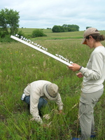
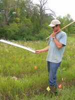
And while I’m back visiting the field blog, here are a handful of photos from the Stipa planting at the end of the summer.


Just a quick note to say that Stipa planting was completed by lunch on Wednesday. We were able to plant the vast majority of seeds where they were randomly assigned in the CG, 10 cm north of existing Echinacea positions on the whole meter throughout the garden. I think only two seeds were not planted at all; one was lost off the board and one was missing its awn and ID sticker. About a dozen seeds had to be assigned new locations, either because there was a hole or a rock in the way or because the plant/staple/can’t find flag that we were measuring from could not be located. Not bad! To assign new random positions, I simply grabbed an ID sticker from the sheet of leftover, unused positions, removed the old sticker, stuck the new and marched around the garden planting the last of my legacy to the Echinacea project. The final task will be to replace the can’t find flags that are associated with a Stipa seed with short pins. Hopefully, this will up the chances of finding seedlings next summer. To this end, we also put a toothpick 1 cm north of every seed. Best of luck to the crew put to this test!
Also, sadly, my time with Team Echinacea is coming to a close. I have accepted an offer for an AAAS Science and Technology Policy Fellowship to work at the Environmental Protection Agency in Washington, DC starting September 1st (gasp, so soon!). I will be working in their environmental risk assessment group, spending MUCH more time at a desk and much less time running around in the field. I hope that my knowledge and skills as a scientist can do some good in the policy world. Thanks for a wonderful year, and a particularly wonderful summer. Stay in touch.
Here are two spreadsheets with information to be made into visor forms.
The first is a list of Echinacea positions we will measure from, in order to plant Stipa seeds. The relevant worksheet is the first one. In the visor form, I would like to be able to see row, position, Echinacea plant status and a column for notes. Breaking this list into multiple forms would be fine.
Complete list of Stipa positions81409.xls
The second is information for the “Next generation rescue” August seedling refind. I would like block, row, position and number of seedlings in May visible and would like number toothpicks, number toothpicks with no seedling, number new seedlings, longest leaf lengths and notes as editable fields.
Nextgenresc-For Aug 09 visor form.xlsx
And finally, Stuart, could you check out some Stipa bunches in Staffenson and decide how close we could comfortably plant seeds next to the Echinacea in the garden?
In response to Caroline’s request for more locations to plant Stipa in the common garden, I have selected 208 new locations at random. This map shows the new locations in green. (Blue dots are the previously selected locations.)  Click this thumbnail to see a full-sized image. Click this thumbnail to see a full-sized image.
Here’s a file listing all 208 location. It’s suitable for making 208 labels for 208 seeds! stipaSeedLabels2.csv
|
|


